Wednesday, March 27, 2013


Stephen Mather - Further Memorial Locations
In my Stephen Mather post of July 29, 2012 I said, "It is my goal to find the Mather memorials in the national parks I visit and pause to remember the 'Father' of the U.S. National Park Service and appreciate the good that he has done for us. Perhaps you will now also engage in this interesting quest."

On a just completed vacation from a Maine winter to a Georgia spring I looked for two Mather bronze-plaque memorials, one in Virginia and the other in New York. Before finding them, I stopped in Darien, CT to see the 1778 Mather Homestead, a national historic landmark, at 19 Stephen Mather Road. Nearby is the Mather Cemetery, where Stephen is buried.*1

Mather Homestead
The first memorial I located was in VA at the Petersburg National Battlefield, the Civil War site of the 9 1/2-month Union siege that led to Lee's surrender to Grant at Appomattox Court House on April 9, 1865. The memorial lies horizontally on a brick stand near the visitor center.*2

Mather Memorial - Petersburg National Battlefield
The second I found with some difficulty at an unexpected location. It was inside NY's Bear Mountain Zoo and affixed to a large boulder on a high prominence overlooking the Hudson River just south of the Bear Mountain Bridge.*3 The bridge, when it opened in 1924, was the world's longest suspension bridge.
Mather Memorial - Bear Mountain
This location raises a question, as the memorial is inside the 5,000-acre Bear Mountain State Park. Recall that Mather was the first director of the federal government's National Park Service. Following his death in 1930, his memorial plaque was placed in most national parks and likely in entities under NPS jurisdiction. I was unaware of a Mather memorial in a state park. Its location might be due to the underlying ground of the mostly demolished Revolutionary War's Fort Clinton or perhaps to President Roosevelt's program to preserve public lands during the 1930s Great Depression via the Works Progress Administration, which was engaged in the park at the time.
I have not come across a complete list of the Mather memorial locations. I hope you join me in this interesting and educational quest to fill in that list. If you do find one, please let me know.

* GPS locations:
1 Mather home - Darien: N41° 06.768'  W073° 28.468'
2 Mather memorial - Petersburg NB: N37° 14.627'  W077° 21.396'
3 Mather memorial - Bear Mountain SP: N41° 19.059'  W073° 59.278'

Tuesday, February 26, 2013


The Dane Trail and Wildwood Stables

On the northwest side of Day Mountain in Acadia National Park is an old trail to the 583-foot summit. First appearing, unnamed, on a 1901 path map, it was later referred to as the Dane Trail. Over a hundred years later it is again nameless and nearly forgotten.

This unmaintained trail, which the Park listed as abandoned in 1999, starts on the Day Mountain carriage road 1/4 mile southwest of the Triad-Day Mountain Bridge over the Park Loop Road.*1  It is marked by a wooden sign attached to a tree that says "Day Mtn." Partially concealed steps are below it at the carriage road's edge.


Dane Trail - carriage road entrance
 
The summit end of the trail is unmarked. The .23-mile trail is a moderate climb guided by small cairns. In places it is blocked by fallen trees and branches; otherwise, the trail is useable if the hiker exercises care. Once at the summit the hiker can descend via the carriage road or the Park-maintained Day Mountain Trail to loop back.


Helen and Ernest Dane
Ancestry.com
The Dane Trail likely came by its name from the Dane property over which it crossed. It was not uncommon for hikers to attribute trail names to properties' owners. By 1911 Ernest Dane and his wife, Helen, had bought property, which they called Wildwood Farm, and were constructing buildings on it. Wildwood Stables now occupies the site.
The name "Wildwood Farm" was not unique to the Danes; it referred back to "Wildwood ranch," a farm run by W. E. Hadlock at the same location from at least 1887.*2  Intermediate owners also called the property "Wildwood."

Ernest Dane was a Brookline, MA, financier, philanthropist and Harvard graduate. In 1909 he bought Glengariff, the Seal Harbor waterfront estate of George Cooksey.*3  He promptly tore it down and replaced it in 1910, still retaining the Glengariff name.
Dane home Glengariff
Seal Harbor Library

A prominent yachtsman, Dane added a wharf to accommodate his boats, which later included the 240-foot diesel-powered, steel yacht Vanda built for him in 1928 at Maine's Bath Iron Works at a cost of $750,000.*4  Like fellow yachtsman J.P. Morgan (February's post), he was a member of the prestigious New York Yacht Club.

The Dane Trail did not originally begin at the carriage road. Rather, it started from an east-west road, built about 1889, known as the Wildwood Farm Road. This connector road provided access to the scenic Bubble Pond and Jordan Pond on the northeast and west sides of Pemetic Mountain. At the Wildwood Farm Road the trail joined trails north to The Triads, three 600-700' peaks abutting the north side of the farm, and trails south toward Seal Harbor. From the Day Mountain summit the trail descended south to the county road (Route 3) with access to the Caves and Tilting Rock, two popular hiking destinations, and continued to Sea Cliff Drive (Cooksey Dr.) at the coast.

Signpost - 1994
David Goodrich
 
A 1972 path map introduced a different trail descending from the north side of Day Mountain's summit. This is the north section of the present Day Mountain Trail and connects directly to the Triad-Day Mountain Bridge. The 1972 map also suggested the formal demise of the Dane Trail by its notable exclusion; subsequent maps also do not show it. Yet, in 1994 a post with a wooden sign stating "Wildwood Farm" and "Dane Trail" was still at the summit entrance to the erstwhile Dane Trail. By 1999 the sign had disappeared from the post and by 2011 the post itself had vanished.*5


Wildwood Farm - unknown date
Seal Harbor Library
Postscript: In 1948 Helen Dane, a widow from the death of Ernest in 1942, donated Wildwood Farm to the U.S. Government. The structures, save the barn, were demolished by the Park in 1958. The barn is still a prominent feature of Wildwood Stables. In December 1983, via a land swap between David and Margaret (Peggy) Rockefeller and the U.S. Government, Day Mountain became a part of Acadia NP.
 
Wildwood Stables - 2010


* Footnotes:
1  GPS coordinates of Dane Trail carriage road entrance: N44° 18.740'  W068° 14.122'

2  William Edwin Hadlock was a Lieutenant Colonel with the 28th Maine Infantry Regiment during the Civil War and an entrepreneurial and prosperous resident of Islesford on nearby Little Cranberry Island.

3  Cooksey, an 1873 English immigrant to New York City where he made his fortune in the grain market, bought and developed tracts of land around Seal Harbor. He built Glengariff in 1891-92 and Sea Cliff Drive in1895, later renamed Cooksey Drive. Due to his wife's ill health, he moved his family to California in 1900 into a new home at Stanford University. His memorial plaque is on Cooksey Drive at N44° 17.462'  W068° 14.099'.

4  Among other yachts built by the Bath Iron Works was J. P. Morgan, Jr.’s 343-foot Corsair IV in 1930.

5  Special thanks to David Goodrich, who provided the 1994-2011 status of the Dane Trail summit signpost.

Tuesday, February 5, 2013


Great Head, Sand Beach and J. P. Morgan
Four miles south of the village green in Bar Harbor on Mount Desert Island, ME, lie Great Head and Sand Beach, two magnificent gems of Acadia National Park. It is still being told and written they were a wedding gift of John Pierpont Morgan to his daughter, Louisa. Alas, that is not the case; but he did buy it for her.

Great Head is a massive granite prominence, which at 144 feet in elevation, stands as the highest cliff on America's Atlantic coast. On its west side, at the head of Newport Cove, is Sand Beach, a 1000 foot-wide shoreline of generally finely pulverized shells. Together they constitute one of the country's most beautiful seashore spots.

Great Head and Sand Beach as seen from The Beehive


Morgan and MDI: The earliest J. P. Morgan would have been in Maine was likely in 1854, when he and his cousin tried to complete a trip through New England. They ran low on funds in New Hampshire and had to make their way to Portland, ME, where they caught a steamer to Boston. Morgan married Frances ("Fanny") Tracy in 1865.*1  It has been written they honeymooned in Bar Harbor, but that too is not the case. They honeymooned abroad; it was her first trip to Europe. Morgan did vacation in Maine in 1875, when he and Fanny visited Bar Harbor and stayed at the newly extended Rodick hotel, then Bar Harbor's largest. During this trip Fanny showed him Great Head and Sand Beach, places she loved and had first visited in 1855 with her father, Charles Tracy. Tracy recorded this trip in his diary.*2

J.P. Morgan - 1881
Frances Morgan - 1902


Morgan made later trips to MDI. He enjoyed steaming from New York to Bar Harbor aboard his yacht, Corsair, and would take her around to Northeast Harbor to attend church services and listen to his friend, Bishop William Doane, preach. In 1897, as the 16th commodore of the New York Yacht Club, Morgan organized the first-ever cup event from NYC to Bar Harbor. The 185-mile race, starting at Vineyard Haven on Martha's Vineyard and ending at a buoy off Baker Island Light, consisted of 16 schooners and 6 sloops.*3  Twenty-three steam yachts, including Morgan's 241-foot Corsair II, witnessed it.*4

The wedding gift: Morgan's daughter, Louisa, married Herbert Satterlee in 1900 at St. George's Church in Manhattan. A capacity crowd of 1,500 guests attended and 2500 were invited to the following reception at Morgan's Manhattan home. His wedding gift to Louisa was a diamond tiara and necklace.

In 1908 Morgan asked his business associate, Thomas Joyce, to buy Great Head and Sand Beach. Joyce completed the purchase for $50,000 in June 1910, following legal settlement of one of Maine's biggest land title cases between the owners' heirs and the trustees of the Bingham estate. Land titles on the island extended back to the original Bingham owners and the dispute concerned how this title had been recorded. Two months later Joyce conveyed the property to Louisa. In his Morgan-authorized biography, Herbert Satterlee states, "He [Morgan] loved the place and was very much pleased that he had at last been able to get it."*5

The donation: Louisa died in 1946 and left her estate to Herbert. He took his own life the next year and his estate went into trust. Three months after his death, the devastating MDI Fire of 1947 swept over Great Head and Sand Beach, destroying most of the Satterlee homestead and scarring the landscape. Daughter Eleanor purchased the property from the executors of her father's will for $22,000 in March 1949. Two months later she donated it to the United States of America for Acadia National Park. There is a memorial on the west side of Sand Beach at the top of the steps to the beach.*6  It explains:

SATTERLEE FIELD
SATTERLEE FIELD OF APPROXIMATELY
100 ACRES WAS DONATED IN 1949 BY
ELEANOR MORGAN SATTERLEE
TO THE UNITED STATES OF AMERICA
IN MEMORY OF HER MOTHER,
LOUISA P. SATTERLEE,
AS PART OF
ACADIA NATIONAL PARK

 
*Footnotes:
1  Frances was Morgan's second wife. In 1861 he had married Amelia Sturges, who was ill with tuberculosis. She died the next year.
2  The Tracy Log Book - a Month in Summer, (ed. by Anne Mazlish). Bar Harbor, ME: Acadia Publishing Co., 1997.
3  The History of the New York Yacht Club, (pub. by the NYYC). 1975.
4  Bar Harbor Record, August 11, 1897.
5  Herbert L. Satterlee, J. Pierpont Morgan, an Intimate Portrait. New York: The MacMillan Co., 1939, p. 523. Photos of J. Pierpont and Frances are from this book.
6  Satterlee memorial GPS coordinates: N44° 19.765'  W068° 11.028'

Thursday, January 10, 2013


Acadia National Park's Other Bar Island

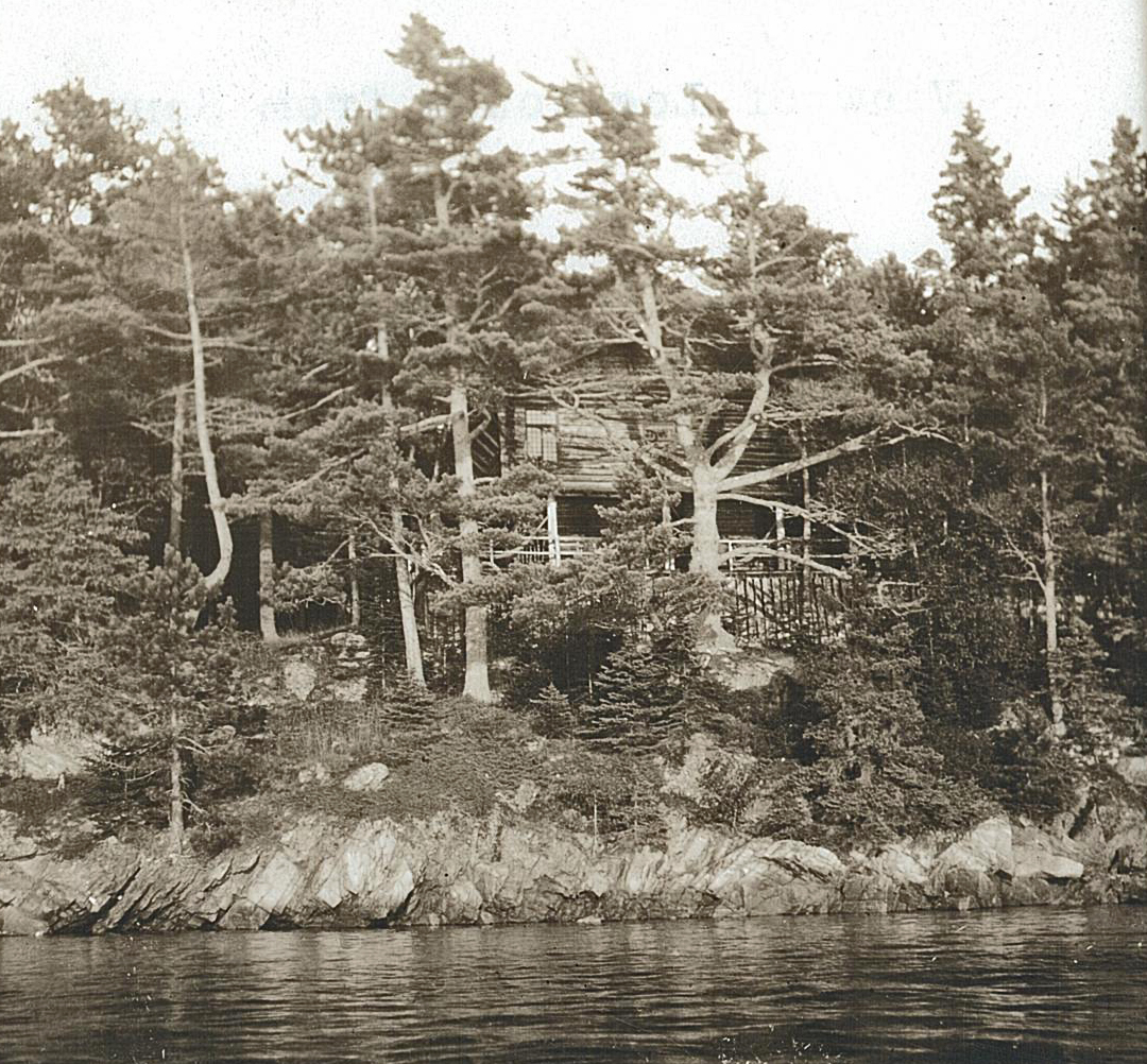
At the north end of Somes Sound outside the entrance to Somes Harbor and off Squantum Point is Bar Island. The 6-acre island was purchased in 1880 by New Yorkers James Williamson Pryor (1858-1924) and his sister Caroline (1857-1934), during a stay at the Central House, a popular venue in Somesville. They built a log cabin on the island, which was described as "a most comfortable summer cottage on Pryor's Island."*1  It was also termed "the first summer home built in Somesville"*2  At the time, the island was accessible by boat or by foot over the bar that connects it to the mainland of Mount Desert Island.


Courtesy: Northeast Harbor Library
An 1887 map shows Bar Island and depicts the locations of the log cabin, a well and a wharf.
Bar Island from the Sargent Mountain Around Mountain Carriage Road
James later deeded his half ownership of the island to Caroline, who in the meantime had married John Pine (1857-1922), a Columbia University friend of his. She redeeded this half to James's wife, Edith Tweedy (1865-1935). On July 18, 1925 the wives, in honor of their deceased husbands, donated the island to the Hancock County Trustees of Public Reservations. The HCTPR conveyed it to the Park on December 3, 1925.

Before official receipt of the island from the HCTPR, the Park used it for a social function. The Bar Harbor Times reported that Park superintendent George Dorr had hosted a luncheon for 60 guests from the Appalachian Club at Echo Lake "at the beautiful log cabin which is part of the fine gift of the island and its buildings to the National Park from Mrs. John B. Pine and Mrs. James W. Pryor."*3

On the northwest corner of the island, on an overlook facing Somesville, is a memorial to James Pryor and John Pine.*4  The memorial, inscribed on granite, states:

THIS ISLAND IS A GIFT
TO LAFAYETTE NATIONAL PARK
AS A MEMORIAL TO
JAMES WILLIAMSON PRYOR
AND JOHN BUCKLEY PINE
A D  1925

Aerial view of memorial location

Pryor-Pine memorial
In November 2011Friends of Acadia-ANP volunteer treated the severely weathered and lichen-encrusted memorial to help preserve the inscription.

Memorial during treatment
Very little of the homestead remains today, apart from a concrete tank, a covered well and the ruins of steps that led to the wharf below. A cleared and flat area might have been a tennis court site.

Concrete tank
Well before covered (2007)
Steps to wharf
Bar Island is an interesting destination to explore, picnic or rest. Nowadays access is by boat only, as the bar connects to private property. Be mindful this access is prohibited between February 15 and August 31st, if eagles are nesting. Check with Park headquarters before your visit.

* Footnotes:
1 Mount Desert Herald, 9/30/1887; [p.3]. Mapmakers have consistently labeled the island as Bar Island; yet, it was often locally referred to as Pryor's Island.
2 Bar Harbor Times, 6/13/1934; p. 8.
3 Bar Harbor Times, 8/26/1925; p. 12.
4 Memorial GPS coordinates:  N44° 21.390'  W068° 19.427'

Monday, December 3, 2012


Acadia National Park's Discarded "Sweet Waters of Acadia" Slab

There is a section in my book, The Memorials of Acadia National Park, called Miscellaneous Engravings. One of those engravings, on page 88, is a granite slab with English and French inscriptions. It is located at an isolated spot in Acadia NP's Sieur de Monts woods, away from all paths, roads and people.*1
 

The 4.5x3-foot semicircularly shaped slab has the French words EAUX DOUCES DE L'ACADIE around its upper circumference and its translation SWEET WATERS OF ACADIA horizontally below.

When I asked about it a few years ago, Park personnel did not know why the slab was in the woods but suggested it might have been discarded there. Perhaps.

Recent research has led me to discover the slab's original location, however.

In 1915 the Bar Harbor Times published that the Sieur de Monts Spring Company, a Maine corporation headed by George B. Dorr, was completing construction of three buildings at Sieur de Monts: a spring cover house, a bottling house and a reception room building. Between the spring cover house and the other two buildings, the article detailed, was "a deep rock-enclosed pool about which will be planted ferns, irises and other native greenery. Close beside the pool will be set a tablet bearing an old French description of the region's drinking water -- Eaux Douces de L'Acadie, with its English translation below, Sweet Waters of Acadia -- while stepping stones will lead out into the center of the pool that anyone passing by may drink of the waters as they boil freshly up."*2

In a subsequent Times article the reception room building was described as a small-framed office building. It confirmed, "… at its threshold is a large flat stone on which is the inscription: 'Sweet waters of Acadia,' which is a quotation from Marc Lescarbot, a [French, c. 1570 – 1641] poet and writer of Sieur de Monts' time, who wrote of their voyage to these places."*3
Sieur de Monts Spring House with bottling house in background c.1930
Source: Maine Historical Society

Today, the bottling and reception room buildings are no longer standing at Sieur de Monts. Just the spring cover house and the Park's nature center building are there, on opposite sides of the pool.

Today with Park's nature center building in background
Though the slab's original location is now known, nagging questions remain:
a. Why is it not at the pool?
     Possibly it was because Dorr wanted a more prominent stone to tout the Sweet Waters of Acadia. In 1915, the boulder with the words "Sweet Waters of Acadia" that now is before the spring cover house was not there. When it was installed, it might have replaced the much smaller slab.
b. Why discard the slab in the woods?
     It is very close to the ruins of what might have been a granite structure and a sizeable pile of Macadam. Nearby is a network of old roads. One of these, Meadow Road, led from Bar Harbor's Ledgelawn Avenue, cutting straight through the swampy east side of Great Meadow. The slab lies at its south end. Another old road, in a direct line with Meadow Road, led south from the Macadam pile. While the nature of the past enterprise there is not known, the inscription on the slab might provide a clue.

Sieur de Monts Pool then
Source: Penobscot Marine Museum
Acadia NP is preparing for its 100th anniversary in 2016. It is also the 100th anniversary of the National Park Service. Already the landscape of Sieur de Monts is changing in anticipation. Long-needed cleanup has occurred in the area of the spring house and the nature center. Unwanted bushes, weeds and small trees have been removed from the pool's perimeter and the Dorr memorial. The nearby Wild Gardens of Acadia are once more looking highly professional and very attractive.

Sieur de Monts Pool today


Perhaps as part of the restoration project, the Park will return the century-old slab to its historic location beside the pool where, once again, it will be at the Sweet Waters of Acadia it proclaims.


*Footnotes:

1 GPS coordinates of the slab: N44° 21.844'  W068° 12.251'
2 Bar Harbor Times, 9/18/1915; p. 1.
3 Bar Harbor Times, 10/21/1916; p. 7.

Sunday, November 4, 2012


Requirements for a National Park Memorial
As the author of The Memorials of Acadia National Park, I'm often asked the question, "How does one establish a memorial in Acadia National Park?" My answer always is, "It's not easy."

A hundred years ago, the situation on Mount Desert Island was quite different than it is here today. In 1901 a group of influential summer residents, under the inspiration and guidance of Charles W. Eliot, then Harvard's president, was worried that development of MDI would forever diminish its beauty. That year they formed the Hancock County Trustees of Public Reservations and chartered it in 1903 for legal status in Maine. They purchased land and sought land donations on MDI, which they later donated to the U.S. Government for federal preservation and protection. The Trustees honored some of the buyers and donors by remembering them or their loved ones in the form of memorials. They promoted these commemorative works as a way to encourage further land donations to the Trustees and U.S. Government. This spirit continued as the Park progressed through its development and expansion as Sieur de Monts National Monument (1916), Lafayette National Park (1919) and Acadia National Park (1929). Thus, Acadia NP came to be composed almost entirely of donated land.

The National Park Service, established in 1916 -- the same year as Sieur de Monts NM, seemed to encourage commemorative works as well. Shortly after its first director, Stephen Mather, had died in 1930, the NPS placed a bronze memorial plaque in his honor in just about every one of the national parks. In Acadia NP Mather's memorial is on the summit of Cadillac Mountain.*1
 
Times have changed. Ninety years after its establishment the NPS issued its Management Policies 2006.*2 On page 140, in section 9.6, titled Commemorative Works and Plaques, the document defines what a commemorative work is and states the rationale and justification for its establishment.
 
            Definition: "commemorative work means any statue, monument, sculpture, memorial, plaque, or other structure or landscape feature, including a garden or memorial grove, designed to perpetuate in a permanent manner the memory of a person, group, event, or other significant element of history. It also includes the naming of park structures or other features—including features within the interior of buildings."

            Rationale and justification: The NPS "will discourage and curtail the use and proliferation of commemorative works except when" authorized by Congress or there is compelling justification for the recognition of the person or event. The document states that compelling justification must meet two criteria: exceptional importance and at least 5 years have elapsed since the death of the person or at least 25 years have elapsed since the event.
 
Despite the certainty and clarity of Management Policies 2006, it is possible to establish a commemorative work in a national park. At least that's the case in Acadia NP. In 2008 the Park installed its latest one on the east side of Jordan Pond.*3  This bronze plaque, mounted on a hillside boulder, commemorates the vision and generosity of Ruth and Tris Colket to Acadia Trails Forever, the joint Acadia NP/Friends of Acadia program to restore and care for the Park's historic hiking trails.*4

Colket Memorial


Since the founding of the Hancock County Trustees of Public Reservations, 47 individuals and 1 organization have been commemorated on Acadia NP property by a plaque, an engraved granite stone or a path name. Within this number are 8 memorial paths the Park no longer maintains and thus they are not shown on current maps.

So, there is hope that others who have given selflessly of themselves to extend, maintain or promote Acadia NP will someday be remembered with a commemorative work. After all, memorials have been at the heart of Acadia NP's origin and growth.

*Footnotes:

1 Mather memorial GPS coordinates: N44° 21.148'  W068° 13.454'

2 To see this document, go to: http://www.nps.gov/policy/mp2006.pdf

3 Colket memorial GPS coordinates: N44° 19.735'  W068° 15.076'

4 For a description of this program, see: http://www.nps.gov/partnerships/acadia_trails_forever.htm

Thursday, October 11, 2012


Dorr's Oldfarm Estate - Volunteer Cleanup

In an earlier post to this blog, entitled "George Bucknam Dorr - the Father of Acadia National Park" (4 May 2012), I mentioned his estate had been neglected for many years; but in December 2011 Acadia National Park let experienced Friends of Acadia (FOA) volunteers, under Park supervision, initiate a cleanup of Dorr's Oldfarm homesite. On October 11, 2012, nearly a year later, the Park again allowed a second supervised FOA volunteer effort to continue the cleanup of the Dorr homesite. FOA sponsors the Park's volunteers.


From 1942 map: Acadia National Park and Vicinity
On this occasion, volunteers filled in four potentially dangerous holes around the foundation with blown ledge and finely crushed aggregate, which was tamped down to a smooth and durable surface.  Other volunteers pruned low tree branches that were overhanging the homesite and nearby roads and paths. Still others carried away fallen or previously cut tree trunks and branches in an effort to make the site more accessible and visible.


Much more work is needed to make the 60-acre estate the showcase many Mount Desert Islanders and Park visitors feel it warrants. The volunteers hope the Park will respond to this essential project accordingly and schedule more work parties.

If you are interested in volunteering at Oldfarm or on the many other projects the Park hosts between June and November, contact Friends of Acadia at 207-288-3340 or the Acadia National Park volunteer coordinator at 207-288-8716. You will find these projects are fun, physical and social and a great way to help keep Acadia National Park the magnificent place that it is.

Thursday, September 27, 2012

J. J. O'Brien and His Jesuit Settlement Memorial

In 1952 a summer resident of Seal Harbor, ME named John Joseph O'Brien (1882-1971) mounted a bronze plaque on a granite cliff in his "Sea Bench" estate garden and invited garden tours to visit and enjoy it.*1  The memorial commemorated the first settlement of Europeans on Mount Desert Island, ME and the introduction of Christianity to the island in 1613. The memorial inscription reads:

FIRST RECORDED LANDING OF WHITE PERSONS ON MT. DESERT ISLAND, MAINE
1613
FRENCH EXPEDITION, UNDER SIEUR DE LA SAUSSAYE, INCLUDING THREE JESUIT PRIESTS, FATHERS PIERRE BIARD, ENNAMOND MASSA, JACQUES QUENTIN AND JESUIT BROTHER GILBERT DU THET, LANDED ON WEST SIDE OF SOMES SOUND AT WHAT IS NOW KNOWN AS FERNALD’S POINT. THEY NAMED THEIR SETTLEMENT SAINT SAUVEUR. SEVERAL MONTHS LATER, A BRITISH FORCE ATTACKED THE COLONY, KILLED BROTHER DU THET AND DISPERSED THE COLONY. BROTHER DU THET’S BODY IS BURIED SOMEWHERE ON THE SHORE OF WHAT IS NOW KNOWN AS THE JESUIT MEADOW.


Jesuit Settlement outside St. Ignatius
O'Brien commissioned the bas relief memorial, a work done by acclaimed Detroit-based, German-born sculptor Walter Midener. It was cast at the Modern Art Foundry in Queens, NY, the same company that made the bronze statue of University of Maine benefactor Harold Alfond. When O'Brien sold Sea Bench, he removed the memorial and attached it to a 4-ton granite slab which was installed outside of Saint Ignatius Church in Northeast Harbor.*2  This was fitting, as St. Ignatius founded the Jesuit Order.


Marian O'Brien
Courtesy: Clewiston Museum
O'Brien, a Philadelphian and a University of Pennsylvania Law School graduate (1908), was a journalist, industrialist, entrepreneur and politician from Grosse Pointe Farms, MI. Upon graduation he entered newspaper work, but he resigned as city editor of the Philadelphia Ledger in 1914 to go to Florida and develop agricultural land. In 1917 in Hillsborough County (Tampa), FL he married Philadelphian Marian Newhall Horwitz (1882-1932), the widow of Philadelphia attorney George Horwitz, and daughter of Daniel Newhall, vice president of  the Pennsylvania Railroad.*3  He and Marian lived in Moore Haven on the southwest side of Lake Okeechobee. There they formed the Southern Sugar Corp., later reorganized as the U.S. Sugar Corp., the country's largest producer of cane sugar, and established the town of Clewiston, "America's Sweetest Town."*4  Marian was elected mayor of Moore Haven, a.k.a. “Little Chicago” from its location on Lake Okeechobee, and became the first woman mayor in the South. She also was president of the Moore Haven bank. By 1924 he and Marian had sold their land holdings and left the area. In 1925, while a Palm Beach resident, O'Brien purchased "Guy's Cliff," a 6-acre waterfront estate in Bar Harbor that today is the site of the College of the Atlantic's Kaelber Hall. Marian died in their Grosse Pointe Farms home and is buried with her son and sister in St. David’s Episcopal Church cemetery, Wayne, PA.

In 1934, two years after Marian's death, O'Brien married Louise Webber Jackson (1883-1960), niece of the founder of Detroit's Joseph L. Hudson department store and widow of Hudson Motor Car pioneer Roscoe B. Jackson. Bar Harbor's Jackson Laboratory, a cancer research facility funded earlier by Jackson, the Webber family and Edsel Ford, is named for him.*5  O'Brien was a Michigan neighbor of Edsel Ford and living close by was Richard Webber, Louise's brother and a family financier of the Jackson Memorial Laboratory. In 1935 O'Brien was appointed the director of the Wayne County (Detroit) Works Progress Administration. The WPA (1935-1943) had a mission similar to that of the Civilian Conservation Corps (1933-1942) -- to provide jobs and income for unemployed, unskilled workers to do public works projects.

John J. O'Brien
Courtesy: Kebo Valley Golf Club
Among O'Brien's accomplishments on MDI, he was instrumental in setting up the Crobb Box Company in Northeast Harbor in 1942 to make shipping crates for Ford Motor Company’s war-related production effort.*6  He was president of Bar Harbor's Kebo Valley Club (1943-1946) and president of Seal Harbor's Harbor Club (1953-1958). Also, he served on the board of trustees of the Jackson Memorial Laboratory and on the Seal Harbor Village Improvement Society. Upon his death in 1971, which occurred at his Grosse Pointe Farms home, O'Brien requested memorial tributes be sent to the Jackson Memorial Laboratory. He and Louise, who died in Bar Harbor 11 years earlier, are buried in Woodlawn Cemetery, Detroit, MI.

J. J. O'Brien's Jesuit Settlement Memorial stands today as a silent witness to a seminal event in Mount Desert Island's history. Its 400th anniversary will occur next summer.

*Footnotes:
1  Bar Harbor Times, 7/24/1952; p. 1.
2  Memorial GPS coordinates: N44° 17.643'  W068° 17.619'
3  George's father, Dr. Phineas Horwitz, a surgeon general of the United States Navy, summered in Bar Harbor from 1879 until his death there in 1904.
4  The O'Briens named the town of Clewiston in honor of their Tampa friend and financier Alonzo C. Clewis.
5  Established in 1929, its original name was the Roscoe B. Jackson Memorial Laboratory. Today its name is simply The Jackson Laboratory.
6  The name Crobb comes from the initials letters of the founders' surnames -- Irving Clement, Gerald Richardson, John O’Brien and Horace Bucklin. Crobb Box continued to produce its lumber products until purchased last year by Pleasant River Lumber.